We recently decided to take a hike up Mt. Cheam (pronounced "chee-am", not "cheem" as you might expect) with a friend. Mt. Cheam is about 2 hours east of Vancouver. The hike is a short 6km but it is steep, rising about 700 metres to a height exceeding 2100 metres.
Our problem was that we believed the weather report. The morning clouds were supposed to clear in the early afternoon so that we would have a cool walk up to have a clear view when we reached the top. Instead we had cold weather and fog the entire hike. The second picture here gives an idea of the conditions.
On the way we met a number of fellow hikers and we promised to show them the view from the top on this website. The pictures were made about a year ago.
The first picture is the view to the south. Here you see Lady Peak with Lucky Four behind it. The Cascade Mountains are in the distance.
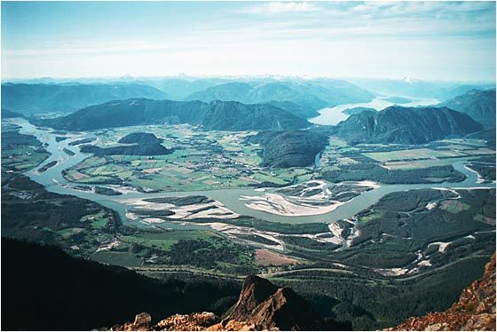
The third picture is the view to the north. This picture was made with a wide angle lens (a 24-120mm Nikkor at the 24mm setting). The Fraser River underlines the township of Agassiz and its surrounding farms. Harrison Lake and the coast mountains are in the background. The Trans-Canada Highway makes its way along the bottom of the picture. A high resolution copy of this image is available here. Note: this file is very large - 2.4MB.
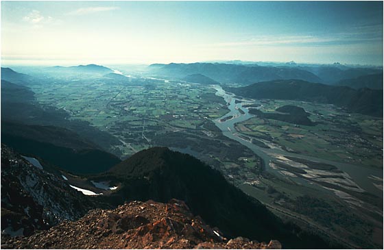
The last picture looks west along the Fraser Valley towards our home, Vancouver. You can see in the distance the clouds coming in from the Pacific Ocean. While we had a sunny day, Vancouver was overcast.